Tuesday 30 December 2014

Don't Panic!

Don't Panic! I've been very quiet on the blogging front for the last few months. But don't worry! A new post will go live 1st of January. It will be followed shortly after by a guest post on the wonders of our coast line and its beaches.

Hope everyone had a lovely Christmas. 2014 years is a blink of the geological eye but still a long time in human experience. It is nice to know that the message of Christmas is still nice and clear even after so many years of human dispute. In the account of Matthew in the Bible, Jesus was presented with three gifts at his birth. Two of the gifts were from plants and the third from the earth. The mineral is still sought after today just as it was many thousands of years ago. This is much like the sadness of human relations and the whole story of Jesus's subsequent life and death... we don't really change do we!

See you again in 2015.

Saturday 13 December 2014

What do people think I do

What do people think that geologists do? Well, here is one answer from the Geosphere Blog.


Sorry all for the delay in posting. Once I get my act together I will post again more regularly.

Sunday 2 November 2014

Unconventional Gas - Gaps in Baseline Data

The NSW Office of Water has been busy compiling a series of videos on YouTube explaining various aspects of hydrogeology. This recent video is about data gaps in understanding baseline hydrogeological conditions in areas of 'unconventional' gas.

Monday 20 October 2014

Blog Update #6

Over 100 000 page views for this blog, 3 years and over 130 blog posts. I honestly did not think that there would be so much interest in the geology of the Northern Rivers. This milestone was topped off by heaps of interest during a short presentation on the weekend at the Big Scrub Rainforest Day.

I was a little worried about my presentation since it directly followed Robyn Williams from the ABC Science Show. His whole professional life revolves around talking to an audience. I on the other hand am not used to public speaking. I wish my talk was more structured and I did not try and condense so much into it. But I think it was received surprisingly well all the same! The questions were excellent and I wish I had more time to answer them. There were still a lot of hands up when I had to hand over to A/Prof Isaac Santos from SCU for his talk.

Following the talk the 100 information sheets disappeared and many people were asking if there was more. So thanks everyone for your interest and sorry that I didn’t have more copies. The information sheets are the short articles I have recently done for a couple of the Big Scrub Rainforest Newsletter. The specific articles can be downloaded from the links below. The full newsletters can be obtained by contacting the Big Scrub Rainforest Landcare Group. http://www.bigscrubrainforest.org.au/

January 2013 – Mt Warning and Reading the Rocks

September 2014 – The Importance of Basalt in the Big Scrub and One CSG Related Anomaly

Regular visitors to my blog may have noticed the slightly declining number of posts over the months. This is nothing to do with a lack of subject matter. I am finding the time a little hard to find at the moment. As such, I am happy to open up this blog to guest bloggers from time to time. If you have a story about Earth Science that has even the slightest New England/Northern Rivers/ North Coast bent, please feel free to contribute to this blog. I can be contacted on the email address listed on the page “about this blog”.

Monday 6 October 2014

Rocks in the Rocky River

Rocky River Monzogranite (Bungulla Suite).
The Monzogranite here contains large crystals of twinned pink K-feldspar.
The Rocky River Road is a very quiet, scenic and out of the way route to travel. It is slow and windy, but a pretty alternative to the Bruxner Highway route between Drake and Tenterfield. I had the pleasure of a trip along Long Gully Road and Rocky River Road just last week. I enjoyed it very much for the scenery and the clear water of the Rocky River (also known as the Timbarra River). The area is also very interesting in a geological sense. The rock that is found along Rocky River Road (the Rocky River Monzogranite) is actually remnants of outer part of a very large batholith that makes up Timbarra Tableland.

Previously, understanding of the inner rocks of the Timbarra Tableland were incorrectly thought to be Moonbi Supersuite, while the outer rocks were correctly part of the Stanthorpe Supersuite. Having two parts of an intrusion being apparently related to different Suites was all quite confused. Mustard (2004) suggested an informal renaming of the Bungulla Monzogranite in the area of Rocky River to the Rocky River Monzogranite. The Rocky River Monzogranite would in turn be part of the Bungulla Suite. The Bungulla Suite being rocks that are I-type (derived from melted igneous rocks) of the Stanthorpe Supersuite.  Although the nomenclature by Mustard (2004) was suggested as informal it is quite reasonable to adopt the name of Rocky Creek Monzogranite as formal. The previous identification of some rocks in the Timbarra Tableland as Moonbi Supersuite has since been shown to be incorrect - they are all Stanthorpe Supersuite.

The Rocky River Monzogranite is in the extensive eastern edge of the Timbarra Tablelands. It is comprised mainly of the rock monzogranite. This rock is comprised of abundant quartz and roughly equal proportions of plagioclase feldspar (sodium and calcium feldspar) and potassium feldspar. There are also smaller amounts of dark biotite mica and amphibole in the rock. The Rocky River Monzogranite is quite a course grained and the crystals are very, very large. The monzonite is notable as it has many 'inclusions' called xenoliths. These are blobs of rock are of a less granitic composition. They are very, very common in some areas as the rock comprises of about 10% or more xenoliths. The xenoliths indicate that mixing of different composition magmas was occurring when the intrusion formed.

A monzogranite tor in the sandy bed of the Rocky River.
Note different sized irregular shaped xenoliths.
Along the very margin of the intrusion (I didn't get to see this) the crystals are smaller in size and the feldspars are even more potassium rich forming the rock syenite. The central area of the Timbarra tablelands is comprised of granitic rocks that were high in fluids when the rock was crystallizing. These fluids (formed by residual enrichment of the original magma chamber), has resulted in the concentration of metals, most notably gold (Mustard 2004). The Timbarra gold mine targeted this inner zone of the tablelands as the outer granite (Rocky Creek Monzogranite) do not contain nearly as much gold. The erosion of the gold has led to alluvial gold deposits in the Rocky River and Clarence Rivers but the gold is very fine grained so fossickers panning can be tricky.

The many components of the Timbarra tablelands intrusion were emplaced in the Triassic period. They intruded the Drake Volcanics. The size of the granite plutons has caused significant contact metamorphism, creating a large metamorphic aureole around the intrusion.

There is much more to say about the zones in the Timbarra tablelands intrusion described by Mustard (2004). This includes the neatness of the tablelands cross section, the way that the slightly different granites tapped different parts of a deeper magma chamber and the way that differentiation of granite types occurred are all worthy of a discussion. Though, this needs more than just a few paragraphs and so I will have to cover these matters in future posts. In the mean time I hope this post gives a taste for some of the 'granite'.

References/bibliography:
*Mustard, R. 2004. Textural, mineralogical and geochemical variation in the zoned Timbarra Tablelands pluton, New South Wales. Australian Journal of Earth Sciences, 51.

Saturday 27 September 2014

Big Scrub Day - October 2014

Every year the Big Scrub Landcare group and many other supporters put together a very interesting day. There are many exhibitors for those interested in natural resource management and restoration, tours of various kinds and workshops. This year is a particularly big year with the Big Scrub day occurring in conjunction with the Rous Water open day. There will be many formal presentations starting off with a key note address by Robyn Williams from ABC's science show. There will also be a lot of emphasis on what is below the ground this year with a presentations including:

  • 'geology of the big scrub';
  • 'the big scrub - a ground water dependent ecosystem'; 
  • 'future water strategy' (which involves groundwater as a key component); and
  • 'ground water and CSG'

I think this year will be very interesting so if you are in the area on Sunday the 12th of October come out to Rocky Creek Dam and have a look around. Maybe I'll see you there (I am actually presenting a short lecture). The schedule for the day is provided above.

Monday 8 September 2014

Volcanic shockwave

A post a little off topic again today. This post is motivated by several related stories in the media. The first is a follow up from an earlier blog post where I criticised the Australian ABC for reporting an eruption in Iceland that was not even confirmed. A day or two later a large eruption occurred in our closest neighbour Papua New Guinea. The eruption was very large and was not even reported by the ABC – though it was picked up by ABC America! It occurred at Tavurvur Volcano near the mostly abandoned city of Rabaul.

On the 11th of September it will be the 100 year anniversary of Australia’s first military engagement in World War 1. Australian soldiers and sailors attacked German positions in the then German Colony of New Guinea. This first engagement, in which both Australian, German and ‘native’ soldiers were killed occurred near Rabaul. The occupation by Australian Soldiers led to Australian administration over Papua New Guinea until 1975. A short account of the battle can be read on the Australian War Memorial Website.

Finally, on the weekend a tourist recorded the moment when Tavurvur volcano erupted again. Though not as large an eruption as the initial one, the power of the volcano is clearly visible. The Youtube video shows massive lava bombs (probably bigger than cars) falling after the eruption and spectacularly a shockwave travelling through the air and hitting the camera. It is worth watching.


Too often we, in Australia forget that we have neighbours. Our news seems to be from the USA, UK a few European countries and ‘home’. But we always seem to forget our near neighbours, Papua New Guinea, Indonesia, East Timor and New Zealand. Let’s not forget the Solomon Islands and even France too (New Caledonia). I’ve previously posted on Indonesia and now I’ve mentioned in passing Papua New Guinea. These are important countries to know about and are so interesting in many ways, one of which is geology. It is beyond the scope of this blog to look in detail at these countries but we should as they affect us, even the geology of those places

Wednesday 3 September 2014

Clarence-Moreton Basin Geology Video

The NSW Office of Water have posted an excellent video summary of the geology of the Clarence-Moreton Basin. It provides an excellent overview.


Monday 1 September 2014

Geological libraries

Sometimes it is important to get your geological references in the right order. Here is a cartoon by Chris Slane illustrating just how important it is to get an accurate geological library.


Monday 25 August 2014

ABC reporters cause a volcano to erupt

"Bararbunga Erupts" was the headline on the Australian Broadcasting Corporation (ABC) Television Bulletins on Saturday night. I've been following events in Iceland so I was interested when the ABC said that it had erupted. At first I was impressed the ABC was able to report an eruption on the other side of the world so quickly (much quicker than any sources I'd seen)... but sadly there was very little detail in the report that actually confirmed an eruption. Yesterday ABC online reported "Lava erupting from a massive volcano under an Icelandic glacier has prompted authorities to issue a red alert to the aviation industry amid fears of significant ash emissions." Sadly, science related reporting by the ABC has been on the decline for years. At the time of writing this post 24 hours after the above ABC news story there has been no definite evidence of an eruption.

VolcanoCafe summarises the current situation:
"...there are so far no other signs of volcanic activity. There is no gas measurements (if they are taken) indicating an eruption being close, neither are there gas or particles in the glacial run off indicating melting ice from an eruption."
VolcanoCafe goes on to say that one outcome may be: 
"the seismic activity decreases and the intrusion lose momentum and no eruption happens at this time. For every day this scenario becomes less likely."
How can the ABC report an eruption has occurred when there is little evidence to suggest it has? Is this a symptom of the ABC losing its ability to report on scientific matters and instead focusing on exciting or political headlines? Even the ABCs flagship science program Catalyst now dismisses research that is carried out by certain groups as evidence that the results are wrong. Catalyst seems to fail to explain why research is flawed in a scientific way. This is a big concern for me because I feel it is degrading science. So much so it is degrading science into politics. Scientific outcomes are questioned on the basis of who did it rather than how it was done.

Now we have the ABC not even knowing when a volcano erupts. It is now more important than ever to question popular science reports.

Update: Another day passes (four days since the ABC report). Still no confirmed evidence an eruption at Bardarbunga had occurred and the Iceland Met Office had reduced its flight path warning a day after the ABC news... Yet no more news on the ABC. Apparently the lack of bad news from Iceland is not news at all. Closer to home - According to the Smithsonian Institute a large explosive eruption occurred at Tarvurvur crater, Rabaul, Papua New Guinea,  on 28th August 2014. Ash emissions reached an altitude of 60,000 ft.

Update: The Iceland Met Office reported that a surveillance flight on the night of the 27th "discovered a row of 10-15 m deep cauldrons south of the Bárðarbunga caldera. They form a 6-4 km long line. The cauldrons have been formed as a result of melting, possibly a sub-glacial eruption, uncertain when."

Update: almost a week after the story of the "eruption" Bardarbunga finally erupts! Iceland Met Office aviation code still Orange. VolcanoCafe has the details.

References/bibliography:

*ABC Newsonline, Iceland volcanic Eruption Closes Airspace, http://www.abc.net.au/news/2014-08-24/iceland-volcanic-eruption-closes-air-space/5692296 accessed 2014-08-25
*VolcanoCafé, Bárðarbunga – Nature of the beast, http://volcanocafe.wordpress.com/2014/08/24/bardarbunga-nature-of-the-beast/ accessed 2014-08-25.

Thursday 21 August 2014

Facebook, night times and Iceland volcanoes

The Northern Rivers Geology blog has nearly a hundred thousand page views! I’m very excited about how much of a success this blog has been. I do want to continue to reach out to a large audience so I’ve taken a reluctant step into social media. I have set up a Facebook Page for the blog which contains links to the latest blog updates as well as other interesting geologically related matters. Let's see how it goes. If you are a Facebook user please follow me. Followers on Facebook can post their own interesting information or even ask questions. Of course readers can continue to comment as usual on this blog.

A picture of sandstone with rock hammer marks at night: doesn't really work.
On another matter, I was travelling into Queensland earlier this week via the Mount Lindesay Highway. It is a scenic but winding road (I was going to use the adjective ‘windy’ but since the weather that day was windy it could have got confusing - crazy English language). I noticed many interesting road cuttings including what appeared to be a coal seam. But, I could not stop because time was against me. I returned back the same way that night so I thought I’d try and do something I’ve never done night-time geology. It was not very successful. Trying to identify the larger scale features in a cutting by torch and car light is not an easy task. Even trying to look at sand grains was beyond me. My assessment of night time geology, don’t bother!

On yet another matter, I want to draw readers attention to this weeks volcanic activity in Iceland. Some interesting things are occurring under glacial cover. The only way that geologists can have an idea of what is going on is by measuring earthquakes. The number of earthquakes around two important concealed volcanoes has been in the many thousands this week. This has made processing the data time-consuming but presently the seismic records indicate some strange "goings on". In particular it appears that magma from the volcano Bardarbunga has made its way into fissures that are part of another volcano, Grimsvotn. This is quite unusual and with the added background these volcanoes have a very turbulent history and have taken many lives, all the more complicated. Volcano café has a good summary of the situation.

Friday 8 August 2014

Crystals or No Crystals?

The landscapes of the mountains surrounding the Tweed Valley are very spectacular. I have discussed some of the facets of the Tweed Volcano and Mount Warning area in previous posts. However, I have not covered much on the main rock type that is mainly responsible for the rugged steep cliffs and valleys of the Nightcap National Park World Heritage Area. This rock is the Nimbin Rhyolite, a quartz rich lava that was dominant in the final phases of the Tweed Volcano. Because of its resistance to weathering it results in inspiring cliffs and rugged ranges.

Rhyolite is a volcanic rock that contains a high volume of silica (quartz) in it. Because of the silica content rhyolite lavas tend to be “sticky” and slow moving. This also causes gases to be trapped in the lava or magma chamber feeding the lava flows. The release of trapped gases can cause explosive eruptions. Therefore, accompanying the lava flows there are also deposits of volcanic ash and glass caused by the rapid cooling of lava during explosive eruptions. All of these features are present in the Nightcap Ranges and surrounding areas.

In a future post I will show a picture of a Nimbin Rhyolite lava which exhibits flow banding. There are many examples of flow banding in lava near Minyon Falls. It is a tricky lava to look at in hand specimen because it is very fine grained. You can only see occasional tiny specks that are crystals but most of the time it is just a grey mass. In outcrop you might see some flow structures like the one pictured, but generally it is a boring looking rock! The same rock is in the Mount Matheson area. Smith and Houston (1995) referred to this rhyolite as crystal-poor rhyolite. It compares very differently to the crystal-rich rhyolite identified elsewhere in the area.

As for the crystal rich rhyolite, I was lucky enough to go for a walk in a property that has just been purchased by the NSW National Parks and Wildlife Service. It is located in the valley between the Goonengerry and Nightcap National Parks. While inspecting the excellent work done to remove exotic weeds from this property and celebrate the inclusion of an important vegetative link between National Parks. I came across some good examples of the crystal-rich rhyolite. In these samples the rock contains large quartz crystals which are very evident (see the picture below). The more crystalline form of rhyolite occurs in about a third of the total area mapped as rhyolite. This includes the area from the Koonyum and Goonengerry ranges in the east to Whian Whian in the west.

Quartz crystals in Nimbin Rhyolite - upper Coopers Creek area
Smith and Houston (1995) observe the crystal abundance is related to the vent (or group of vents) from which the lava was erupted. Only occasionally do crystal rich and crystal poor varieties occur on top or under each other indicating a high degree of lava mixing. The relationship between specific vents and crystal richness shows the vents must have been tapping different magma sources (different magma chambers). Alternatively the vents may have erupted magma from a single, somewhat heterogeneous magma chamber.

However, it is worth noting there is a third major form of rhyolite in the area and is known as the volcanic glass, obsidian. This volcanic glass occurs around the bases of the major lava flows and is often referred to as perlite. The glass is rarely a massive unit but tends to appear brecciated and as an agglomerate. I will discuss this obsidian further in a future post as many interesting features and textures are preserved showing the way that rhyolite lavas move across the lands surface. In the mean time, it is worth remembering that lavas ain’t just lavas. There can be many differences which provide a window into how the landscape was formed.

Wednesday 23 July 2014

The Great Dividing Ranges and Stonehenge

Granites occur throughout much of the north coast and New England region. I use the term granite here loosely, in reality the rocks I’m referring to have a range of compositions and ages. The things they have in common are their relatively high quartz content and they are igneous intrusive (plutonic) rocks. They have cooled slowly and therefore have allowed large crystals to form – giving them that typical granite appearance. I’ve covered a few granites in previous blog posts but in this post I’ll cover one New England “granite” called the Wards Mistake Monzogranite. I’ll continue to cover others in future posts.

Stratigraphically the Wards Mistake Monzogranite is part of the Wards Mistake Suite which in turn is part of the Uralla Supersuite. The Wards Mistake Monzogranite outcrops in a relatively extensive area between Glen Innes and Guyra. In places it straddles the Great Dividing Range but mainly occurs just on the eastern side within the upper reaches of many Clarence River tributaries. The unit was formed around 250million years ago, during the Lower Triassic to Lopingian (early Permian period).

The Wards Mistake Monzogranite consists of monzonite (a rock containing moderate quartz with equal parts potassium and sodium-calcium feldspar) with some granodiorite (abundant quartz and calcium-sodium feldspar). It has a typical equigranular black and white speckled appearance which is common of the Uralla Supersuite. It is like the other Uralla Supersuite granites as it is derived from the melting of other igneous rocks - I-Type Granites (Bryant et al 2003). However, it does contain some xenoliths (inclusions of other rock) which are sedimentary. It is possible that when the Wards Mistake Monzogranite was emplaced into the crust it incorporated bits of the surrounding sedimentary rock. This may have affected the chemistry of the magma and may be one of the reasons why there is both monzonite and granodiorite in the unit.

Typical tor outcrops of the Wards Mistake Monzogranite near Glen Innes
Many New England granites contain mineral deposits. Being an I-Type granite usually means a good chance of mineral deposit formation. However, the Wards Mistake Monzonite contains very sparse mineralisation with only a few small areas where there is some alteration zones that have more concentrated ore minerals. These include wolframite (tungsten), molybdenite (molybdenum) and cassiterite (tin) (Brown 1997). Other surrounding granites such as the Kingsgate Granite and Red Range Leucogranite have abundant mineralisation that was historically mined and is still under active mineral exploration permits.

A lovely feature of most New England granites is the interaction with the climate. This produces wonderful looking granite tors. This is a result of onion skin weathering (frost wedging) where water penetrates into the rock and freezes during the cold winters. This repeated action causes large flakes of rock to peel off. Some of these Tors are given their own names. In the Stonehenge area on the New England Highway you can stop and walk among these Tors and see the Balancing Rock which looks like it will topple over at any moment.

The landscape around Stonehenge between Guyra and Glen Innes is my favourite landscape in Australia. The high country agriculture, the cold weather and the geological conditions that form the rolling hills and special tors make it a special place. The picture above is of a portion of the Wards Mistake Monzogranite and partly shows the landscape I’m talking about. The accessibility of the granite is certainly worth a quick stop if you are travelling on the New England highway.

References/bibliography:

*Barnes, R.G , Willis, I.L. 1989. Preliminary geological plan of the 1:250 000 Grafton-Maclean sheet area - SH 56-6, SH 56-7. New South Wales Geological Survey Report

*Brown, R.E. 1997. Mineral deposits of the Glen Innes 1:100 000 map sheet area. Geological Survey of New South Wales. Quarterly Notes 103 p1-19

*Bryant, C.J. , Chappell, B.W. , Blevin, P.L. 2003. Granites of the southern New England orogeny. In Blevin, P. et al (eds) Magmas to Mineralisation: the Ishihara Symposium Geoscience Australia. Record 14 - extended abstracts.

Sunday 6 July 2014

The Orara Formation and the reviewed Kangaroo Creek Sandstone

There has been an increase in our understanding of the Clarence-Moreton Basin in recent years. The central upper portions of the basin have had several cored and un-cored boreholes drilled during exploration for natural gas, especially Coal Seam Gas. In this post, I will cover the implications of this exploration on our understanding of the Kangaroo Creek Sandstone and the recognition of another previously unknown unit.

In a previous post I described the Kangaroo Creek Sandstone. This unit was identified as a formation directly overlying the Walloon Coal Measures (and the MacLean Sandstone Member of the Walloon Coal Measures) (McElroy 1963). However, a recent paper (Doig & Stanmore 2012) attempts to resolve newly identified characteristics which have resulted in the authors proposing the creation of a new formation called the Orara Formation. It is proposed by Doig & Stanmore (2012) that the Orara Formation is comprised of two member units. These are another new unit called the Bungawalbin Member and the now demoted Kangaroo Creek Sandstone Member.

Doig & Stanmore (2012) found that the proposed Bungawalbin Member differed substantially from the Kangaroo Creek Sandstone and overlying Grafton Formation. They describe the Bungawalbin as between 45m-115m thick and dominated by mudstone and carbonaceous mudstone that is thinly bedded with fine grained sandstone with increasing amounts of massive, medium-grained quartzose sandstone beds near the base of the member. The unit is interpreted as a persistent low energy riverine floodplain environment.

The Bungawalbin Members contact with the underlying Kangaroo Creek Sandstone Member is transitional. With the medium-grained quartz rich sandstone becoming dominant in the Kangaroo Creek Sandstone. The composition and formation history of the Kangaroo Creek Sandstone has not been questioned but the significant fine grained component of the Bungawalbin Member necessitates the distinction between these two members. Additionally, Doig & Stanmore (2012) clearly demonstrated that the geophysical response of the Bungawalbin Member was substantially different from the Kangaroo Creek Sandstone.

Hence, we are learning more about the land on which we live. The geology is slowly becoming better understood. It is interesting to observe that there has been no detailed work on the upper most formations of the Clarence-Moreton since the 1960’s. The drilling that has occurred has unlocked more hidden characteristics of the basin. It helps our understanding of basin history as well as the original intention of finding gas resources. There is more to cover in future posts including understanding of the basins youngest formation, the Grafton Formation, but that will come soon.

References/bibliography:

*Doig, A. & Stanmore, P. 2012. The Clarence-Moreton Basin in New South Wales: geology, stratigraphy and coal seam gas characteristics. Paper presented at the Eastern Australasian Basin Symposium IV. Brisbane.
*McElroy, C.T., 1963. The Geology of the Clarence-Moreton Basin. Memoirs of the Geological Survey of New South Wales, Geology. 9.

Tuesday 1 July 2014

On the Rocks

Three of the four in my family has been hit by the Flu. The only one that thankfully doesn't have it is the newborn. I hope he doesn't get it. Now, I wish I had taken that free flu-shot that my work offered me this year! I've infected most of the family! Obviously this means that original blog posts are going to be a bit light on for a little while. So, in the mean time I can recommend some interesting bits and pieces on the internet.

On the Rocks with Wangiwriter - Catherine Hill Bay
Today Wangiwriter presented a very interesting blog post on some of the rocks of the Newcastle area, part of the Sydney Basin. The pictures are lovely and Wangiwriter tells an interesting story. I know this is a bit out of the usual subject area but the piece is worth a good look. I've been to Catherine Hill Bay and loved the scenery. The geology was typical of a section of the Permian aged Sydney Basin but well exposed and situated in a stunning historical landscape. The conglomerate shown so well in Wangiwriters photographs are part of the Newcastle Coal Measures. Specifically, they are either part of the Moon Island Beach Formation or the Boolarroo Formation. I don't know Newcastle geology well enough to know exactly which.

Thanks to everyone that has been supporting my blog. I've noticed an increase in my advertising revenue of late. Now I'm up to at least a cup of coffee a week! I'm amazed at the value of some advertising clicks. Some earn more than $1, others just a few cents. I got excited when I see that Google payed my almost $1.70 for one click. I wonder what that advertisement was! I'll never know because Google handles all the advertising in the background.

Tuesday 24 June 2014

Earth Learning Idea

I have recently come across an interesting and easy to understand site that explains earth processes in fun and creative ways. This is a site called Earth Learning Idea. By way of examples here is a demonstration of sink holes that you can try yourself (just like those I mention in the addendum to this earlier blog post):
http://www.earthlearningidea.com/PDF/185_Sink_hole.pdf.

I'm pleased to see such an interesting site. It made me wonder whether I should be more pro-active in earth science education. Recently helping to sort out a rock collection for a local environmental centre is something that I enjoyed. I've also been honoured by an invitation to do a formal presentation at this years Big Scrub Rainforest Day. I'm happy to do these things because I enjoy geology and I enjoy talking with people.

Interestingly, as a member of the Geological Society of Australia I can be more formally aligned with geology education by joining the Specialist Group in Geological Education. I just don't want to stretch myself too far as I'm already a member of three specialist groups: the Environmental Engineering and Hydrogeology Specialist Group, Specialist Group in Geochemisty, Mineralogy and Petrology and the Specialist Group in Vocanology (Learned Australasian Volcanology Association). I have another 6 months to decide... I think it is good to take time in making decision... even if this is a little one.

Saturday 7 June 2014

Blog Update #5

It has been about a year since my last blog update. I'm pleased with how well the blog is ticking along though I've been a bit slow in posting sometimes and I am still neglecting many areas. The area between Camden Haven and Coffs Harbour is regularly neglected, so too the New England highlands. I also tend to leave at least one typo per post! Not for the first time I will try and remedy these issues in future posts.

The next few months will have a focus on several areas:

  • Continuing on the hydrogeology theme;
  • Points of interest in the Macleay River catchment;
  • The Mount Warning Central Complex;
  • Recent reviews of the upper stratigraphy of the Clarence-Moreton Basin;
  • Some more posts on gas resources; and
  • A granite intrusion or two in the New England tablelands

While I'm looking both backward and forward. I'm looking forward to reaching 100 000 page views in the next few months. At the time of this post there were over 85 000 views though I estimate approximately 20% of these are not human visitors.

I'm also looking forward to the pocket money this blog is now helping me with. Visitors will notice advertising in the top right corner of the page. When visitors click on these ads I receive between 1cent and 80cents from Google. These ads are not ones that I choose but are placed by Google Adsense based upon the content of this page and your own Google search history. So far I've noticed ads for fracking companies, TAFE and universities and even Clive Palmers Australia Party! I've had advertising for about 2 months now and I've made enough for about 4 cups of coffee. How exciting!

Thanks to everyone for continuing to visit and comment. I appreciate comments and try to respond to all of them.

Sunday 1 June 2014

This is what one aquifer looks like

In some amazing places you can immerse yourself in an aquifer. These places are rare and dominated by a rock type that does not occur in any substantial amounts in our region. However, people dive in the sub-terrainian waters of the limestone caves of the Nullabour in South Australia. The best aquifers in our region do not contain large caves compared with limestone areas. They are hosted in riverine alluvial sediments, fossil soil horizons in volcanic rocks, or fractures in hard metamorphic and volcanic environments. The main aquifers being on the coastal river flood plains, Alstonville Basalt and the New England areas respectively. However, volumetrically the sources that are very large are those in coastal sands.

Auger containing saturated sand from the Woodburn Sands
This post is an illustration of how one of those coastal sands aquifers looks. I've covered the Woodburn Sands in several previous posts but a quick summary is still needed. The Woodburn Sands are beach and dune sand that was laid down during the last significant interglacial. This was around 130 000 years ago during the Pleistocene period. The sea level was much higher than now and this meant that beach systems were often formed a significant way inland.

From the picture you can actually see what the medium that hosts an aquifer looks like. The Woodburn Sands are just that, sands. The sand grains are mostly quartz but there are also some grains made from volcanic and metamorphic rock fragments. Occasionally you can see grains of heavier minerals that were mined until the 1980's. The sand grains are very similar in size which is typical of wave and wind sorting. There is a very small fine fraction of clayey material.

Where the clay content is higher the ability of the water to flow through the aquifer is reduced. This is why some bores can only produce a small amount of water compared to the huge volume that is in the whole aquifer. This is an example of why aquifers tend not to behave as underground lakes. You can pump water out of one end and run out because the hydraulic conductivity (flow velocity) is not high enough to allow the water at the other end of the aquifer to flow in.

The Woodburn Sands is not the only important coastal sands aquifer in the region. Another very important water source include the Macleay sand coastal aquifers. These aquifers were formed in a similar way to the Woodburn Sands and are used for similar purposes. Usage includes irrigation, stock, domestic use and town water supply for places such as Kempsey and Evans Head. There are also some interesting arsenic contamination issues in one aquifer system (Stuarts Point) in the Macleay area which I will post on in the near future.

The similar characteristics of the coastal sands aquifer systems in the North Coast area has motivated the NSW state government to develop a Water Sharing Plan for these systems as a whole. The Water Sharing Plan is expected to be formally adopted this year (2014). Local governments regard groundwater from the coastal sands aquifers as very important. Rous Water has recently adopted its future water strategy which identifies coastal sands as the main source of additional information in the medium to long term and Mid-coast water have recently increased their production of groundwater for drinking too.

Available here is a presentation by the NSW Office of Water on the overall coastal sands systems in North East New South Wales

Monday 19 May 2014

Geology, stratigraphy, water and CSG a bit more understood

A CSIRO researcher recently provided me with a copy of a conference paper on the Clarence-Moreton Basin that I have been searching for (Doig & Stanmore 2012). I was looking for this information for quite some time as I thought there was much to be learned from it. This is because the research was based upon coal seam gas (CSG) exploration results. It did not disappoint me at all. I have previously blogged on the stratigraphy of the basin but frequent visitors will be aware that there has been a hiatus on this topic. This is because I knew more information had been compiled as a result of gas exploration in the region. In particular this was to do with the Grafton Formation and Kangaroo Creek Sandstone. You can read my previous posts but note that Doig & Stanmore (2012) propose to reclassify these units (see figures 1 and 2 on this post). The information my previous posts were based upon Wells and O’Brien (1994). This is still the most comprehensive guide to the basin but now there is potentially some significant refinements.

Interpretation of the stratigraphy of the upper sequences of the Clarence-Moreton Basin
after Wells & O'Brien (1994) and Willis (1994)
Doig & Stanmore (2012) noted that CSG exploration drilling has provided important clues to the layers that make up the Clarence-Moreton basin that were inferred only through limited field exposure. Drilling provides a nice continuous profile which can be compared to other drill holes and to outcropping information. In the case of Doig & Stanmore (2012) this has completely redrawn the stratigraphy of the upper Clarence-Moreton Basin.

Reviewed Clarence-Moreton Basin stratigraphy after Doig & Stanmore (2012)
I will go into more detail in future posts but I note that Doig & Stanmore (2012) have made some major changes to the Grafton Formation. In particular, they have identified two new distinct members of the formation. The Piora Member and the Rappville Member. As for the underlying Kangaroo Creek Sandstone, this spatially and significant unit has been demoted simply to a member of a newly proposed formation called the Orara Formation. The Orara Formation itself has two distinct formations the demoted Kangaroo Creek Sandstone Member and the new Bungawalbin Member. (See figure 2).

The Woodenbong beds don’t get a guernsey at all in this paper. I suspect that this is because it would better fit into either the Bungawalbin Member of the Kangaroo Creek Sandstone or the Piora Member of the Grafton formation. More work needs to be carried out to make it more certain.

Clearly we do not understand much about the Clarence-Moreton Basin. Even the shallowest geological components! Knowledge keeps improving the more people investigate. The paper provides further interest because identification of the stratigraphic units and geochemical data obtained provide an indication of the risk associated with groundwater resources and CSG production. So as usual, further blog posts are required.

References/bibliography:
*Doig, A. & Stanmore, P. (2012). The Clarence-Moreton Basin in New South Wales; geology, stratigraphy and coal seam gas characteristics. Paper presented at the Eastern Australian Basins Symposium IV, Brisbane.
*Wells, A.T. & O’Brien (1994). Geology and Petroleum Potential of the Clarence-Moreton Basin, New South Wales and Queensland, Australian Geological Survey Organisation, Bulletin 241.

Tuesday 6 May 2014

The Game of Thrones - Geological Map


Time again to delve into the region of geological fantasy. I have previously noticed that Middle-Earth from the J.R.R. Tolkien’s Lord of the Rings has had its climate modelled. But I’ve never seen anybody actually recreate a fantasy world’s geology, until now. Miles Traer and Mike Osborne from Stanford University has done just that. He has created a geological map and recreated the geologic history of the lands from the series Game of Thrones.

I’ve only watched one episode of Game of Thrones myself. I found it a little to confronting and violent. Yet, the storyline was very good. I can see why people really like the series. Though I’m a little surprised that someone is obsessed enough to develop a geological history of the area.

Miles Traer’s blog on the geology of Westeros and Essos can be found here.

Mike Osborne’s account of the geology of the Game of Thrones lands can be found on the American Geophysical Union Blog here.


Monday 28 April 2014

Clarence-Moreton Basin CSG Bioregional Assessment with some Philosophy


I was fortunate enough to be invited to a short presentation on hydrology and coal seam gas in the Clarence-Moreton basin last week. It was particularly good, in part, since lunch was provided and one of the presenters from the CSIRO ended up being someone I knew but had not seen for nearly a year. The topic of the presentation was an assessment that has recently commenced on the effects of coal seam gas (CSG) on water resources. Alas, it is something that the media has all but ignored. So a bit of information and a bit of philosophy in the blog post today!

This year a large investigation (a bioregional assessment) into all the possible effects of CSG on water commenced in earnest. It is a project funded by the Federal Government with many scientific project partners including the CSIRO. The project is based exclusively in the first case, on the compilation of scientific information. It is at arms-length from government and politics, so it is entirely technical. Therefore, this assessment is something which I personally find interesting and feel is of great value. The project scope has been set up by the Independent Expert Scientific Committee on Coal Seam Gas and Large Mining Development. The committee was established in 2012 and works under the authority of the Environmental Protection and Biodiversity Conservation Act 1999. A link to the CSIROs summary of its involvement can be found here.

The Clarence-Moreton basin bioregional assessment itself is one part of many bioregional assessments in numerous Australian coal basins. These assessments are themselves divided up into many different components including hydrogeology, ecology, ecotoxicology, environmental protection and many others. The presentation that I attended was specifically related to the hydrogeological modelling that is being developed. It briefly covered the different data sources and data limitations that were going to go into the modelling. It was good to see the thoughtfulness and consideration given to all the hydrogeological issues. Sometimes just figuring out what needs to go into a model is very hard in itself… but by far the hardest task is making sure the modelling reflects the real world. This is because of the varying amounts of "weighting" required to each of the input variables.

However, one of the things that saddens me is the lack of media time this assessment has been given. Many people are concerned that not enough is known about CSG activities in our region or in Australia or even more broadly, around the world. The media tends to focus on the conflicts that are occurring and not on the advances in technical knowledge that will lead to better decision making in the near future. The media does not seem to like reporting on things that we are learning but instead increases the confusion about matters that could lead to social conflict. Conflict, not cooperation seems to sell newspapers these days.

I was also a little saddened by some questions that were asked of the CSIRO presenters. One (Environmental Economics and Policy Academic!) asked whether it was ethical to undertake this assessment because it may lead to a CSG development being regarded as “safe”. To consider an increase in human knowledge of the world in which we live un-ethical is a big worry for me. Especially from a senior academic. In many ways it questions the very basic concepts of scientific endeavour. Having a scientific background, I feel we should not avoid learning something new because the facts that may arise could potentially contradict with a pre-determined world view. We are of-course moving from science to philosophy. I know my philosophical motives in life are to use knowledge to give the best outcomes for the environment and people that live in our region.

So, to end on this philosophical note: I recommend thinking about the knowledge that we have and how we use or ignore it. The media practice of looking only at conflict and dumbing down its stories on scientific and technical matters is well entrenched. I’m starting to genuinely believe that the media is making it harder to distinguish between facts and opinions purely in the media’s self-interest of creating a story to make money from. Recognising this is helpful to understanding where scientific information can guide us in the right decisions, as such I provide here a link to an ABC presentation on the media by an excellent modern day philosopher (one of my favourite non-science authors) Alain De Botton.

Monday 7 April 2014

Where Does the Groundwater Flow?

There has been renewed interest in groundwater resources in the Northern Rivers of late. In part this is due to peoples concern about "unconventional" gas exploration and production in the area. Surprisingly, less known is the release of Rous Water's Future Water Strategy which includes groundwater as first on the list for new water sources. Rous Water is a major bulk drinking water supplier in the region. I've previously covered an area within the coastal sands groundwater source called the Woodburn Sands but this was a cursory look and I'd not covered where the groundwater actually goes.


Groundwaters do not exist as an underground lake in our region
Image courtesy of International Association of Hydrologists
Groundwater is often seen as a bit of an unknown, a black box, or some kind of underground lake (see the cartoon). It is quite difficult to observe and therefore people can get the wrong idea of what goes on underground.

One area that is not understood is that groundwater usually discharges somewhere. Sometimes groundwater discharge is obvious through springs. But where it intersects with permanent surface water it is much less obvious. The Evans Head area is a good example of where discharge from the Woodburn Sands aquifer and broader Coastal Sands aquifers is concealed.
Spring-fed creek on Chinaman's Beach.


While walking along Chinaman's Beach south of Evans Head during a recent long dry spell, I couldn't help notice the dark coloured water flowing over parts of the beach. This is one of those discharge areas I'm talking about (most people might be more used to seeing freshwater flowing over a beach from contaminated urban stormwater drains). The coastal sands above Chinaman's Beach holds groundwater and slowly discharges it at the beach. The dark colour of the water is from dissolved humic matter from coastal vegetation soaking into the sand. Tasting the water it was apparent there was no salt in it and understanding the groundwater area I knew it was clean. The springs I observed on Chinaman's Beach were obvious areas of groundwater discharge. The vegetation in the springs was lush and clearly reliant on the groundwater. This is formally known as as groundwater dependent ecosystems.

The lesser known discharge is not all through visible springs like those on Chinaman's Beach. Much of the discharge from the coastal sands aquifers is actually concealed by the sea. It might be a surprise to many in some areas just off the coast there are zones with freshwater. The amount of water that can be discharged underground into the sea can exceed the discharge from terrestrial springs (e.g. Santos et al. 2009). These are the undersea equivalent of the Chinaman's beach springs. This is interesting from a aquatic ecology point of view because it may mean that there are ecosystems in the ocean that are dependent on freshwater! That is, groundwater dependent ecosystems in the sea.

Groundwater is an interesting feature of our region. It is a source of drinking water, irrigation water and even industrial water. It is often important as some ecosystems are dependent on it. It is also surprising since ecosystems can be dependent on fresh groundwater even when out to sea.

Postscript: about a month after this blog post a story emerged in the local newspaper about sinkholes or zones of quicksand on Chinamans Beach. These quicksand 'pits' look just like typical groundwater discharge areas. The Northern Star article can be found here.


References/Bibliography:
*Santos, I.R, Burnett, W.C., Chanton, J., Dimova, N. & Patterson, R. (2009). Land or Ocean?: Assessing the driving forces of submarine  groundwater discharge at a coastal site in the Gulf of Mexico. Journal of Geophysical Research. vol114.

Tuesday 1 April 2014

Filling a gap with weathering textures

I've been a bit slack lately in posting. I usually have a post ready to go on the first day of every month with a few more over the month. But not so this time. It seems that life just hasn't given me the time to write over the last few weeks. So instead no post at all, here are a few pretty pictures of weathering patterns from the area.


Phyllite of the Neranleigh-Fernvale beds. In this case the darker part of the rock has been preferentially eroded by wind and wave action creating the early stages of a tessellated pavement. The quartz veins that are present stand proud from the surface. Technically this is not actually weathering per se... but oh well it looks pretty.
Weathering of the cross-bedding in this sample of Kangaroo Creek Sandstone develops a very pretty pattern.
Differential weathering in phyllite of the Neranleigh-Fernvale beds. The fabric of the rocks leads to some minerals being more susceptible to weathering by reactive sea water.

Tuesday 25 March 2014

Fracking qualifies for aged pension


Over on the About Geology Blog, Andrew Alden shows us that yesterday was the 65th anniversary of Hydraulic Fracturing (Fracking/Fraccing). I was quite surprised to learn that this “unconventional” technique was developed in my grandparent’s generation. In his blog post Andrew points out some of the controversies in the United States about “Fracking” and provides his opinion on the practice. I don’t want provide to provide any opinion here about the Australian situation, just to outline a very quick summary of how it is used.

Having said the above, I think it is important to mention that there is some differences in experience between Australia and the United States. The main difference being that any chemicals used in “Fracking” must be fully disclosed (unlike the USA where they are much more secretive). Another difference is that in the USA “Fracking” is most commonly used in “Shale Gas” formations where it has been reportedly been linked to many problems with regard to aquifer cross-connection and contamination. Coal Seam Gas in the USA are also a situation where Fracking is frequently used, though this has very few of the same issues of Shale Gas fracking (Blackam 2014).

In Australia “Fracking” is frequently used in “Tight Gas” situations where directional drilling alone is impractical. This practice is especially common in the Moomba Gas Fields of Queensland and South Australia now this field has become depleted in the easily accessible “Conventional” gas. Hydraulic fracturing is also sometimes used in Coal Seam Gas situations. In the Northern Rivers I understand there has only been one case of hydraulic fracturing which was used in a “tight” situation.

This is by no-means a clear bill of health for unrestricted use of the practice of Fracking. Many questions still remain about what damage the practice can cause (e.g. Batley & Kookana 2012).

I’ve done some posts on the different natural gas sources and summarised them on this page. Until I actually do a blog post on what hydraulic fracturing actually is, I recommend this summary from the CSIRO. Alternatively, this CSIRO/Industry publication, though developed in partnership with the gas industry is actually even more detailed and very good.

References/Bibliography:

*Batley, G.E. & Kookana, R.S. 2012. Environmental issues associated with coal seam gas recovery: managing the fracking boom. Environmental Chemistry. vol9 p425-428
*Blackam, M. 2014. Source, Fate and Water-Energy Intensity in the Coal Seam Gas and Shale Gas Sector: An Exploration of the relationship between energy and water in the unconventional gas sector. Water, Journal of the Australian Water Association. vol41 No.1 p51-56

Friday 14 March 2014

Armidale submerged

Armidale is well known for its height above sea level, with some areas above 1000m it is at a relatively high altitude by Australian standards. The city is located in the New England, ‘Northern Tablelands’ which provides an indication of the landscape in which it is situated. The area resembles a very large plateau with comparatively light rolling hills compared with the nearby escarpment and edges of the tablelands. In fact, Armidale is just a tiny bit to the east of the crest of the Great Dividing Range. Surprisingly, this area was in part inundated by a lake, or lakes.

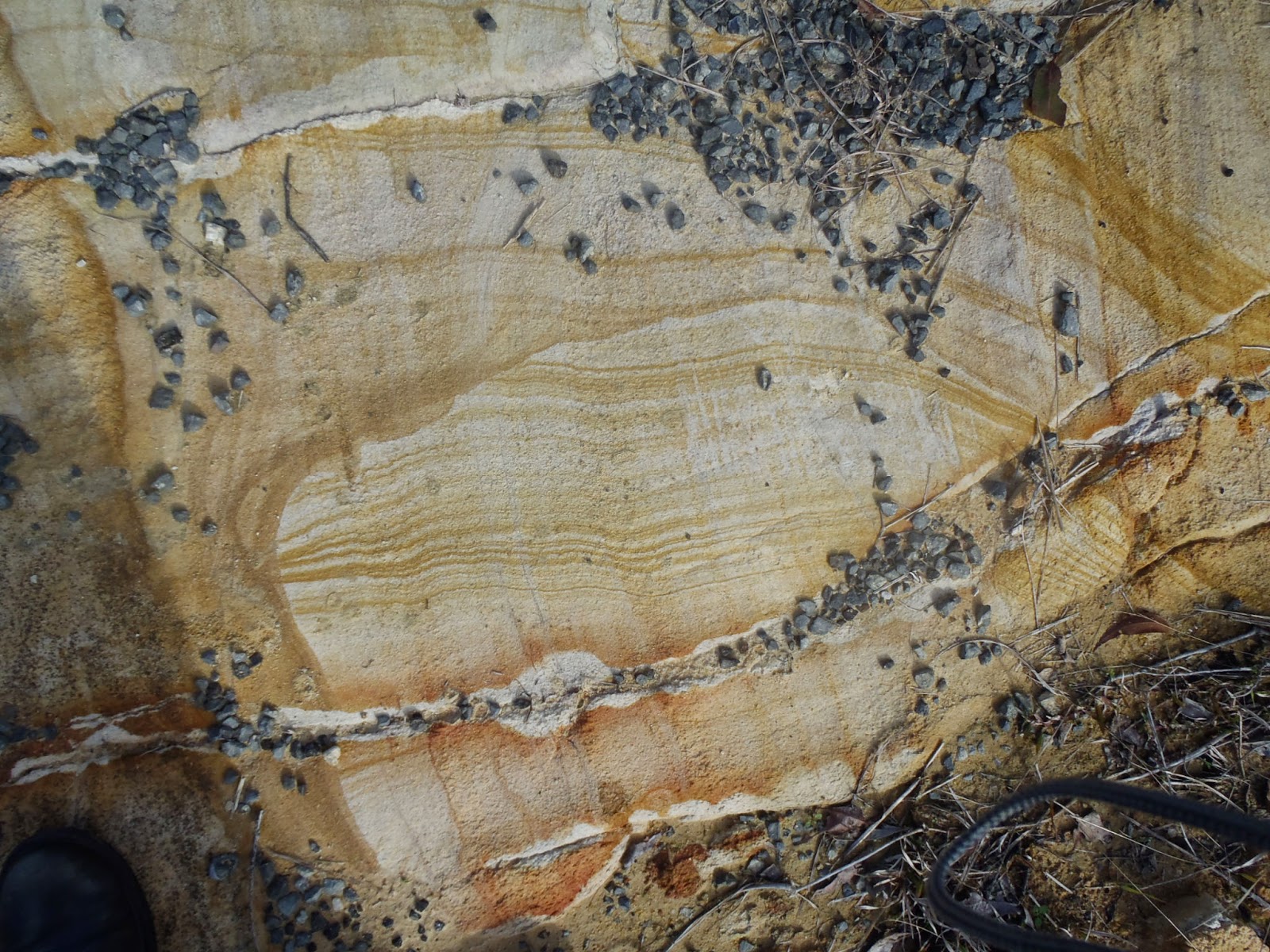
Examples of some rocks that make up the Armidale beds
The big sample at the front has been partially turned into silcrete.
One of the headwaters of the Macleay River, Dumaresq Creek flows through Armidale. In places this creek, as well as other creeks in the area, have cut through the basalt rock that covered the area. A description of this process was covered in an earlier post. In this post I’d like to describe the sediments that lie under the basalt. These are Eocene (or earlier) sediments named by Voisey (1942) the Armidale Series, now known as the Armidale beds.

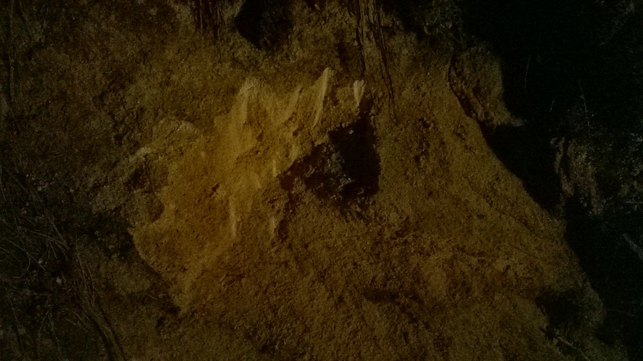
The Armidale beds are comprised of fluvial (river) and lacustrine (lake) deposited sediments. These are principally conglomerates, siltstones, sandstones and shale. Interestingly, the shales are laminated possibly as a result of seasonal deposition in a lake. They also contain abundant plant fossils. The material that makes up the sediments is particularly obvious in the conglomerate. The conglomerate clasts are derived from the older underlying geology, for example clasts of jasper, quartzite and granites.

The Armidale beds occur in small remnant areas (the balance of the beds having been eroded away). These remnants occur throughout the Armidale area but almost as far away as Wollomombi to the west, near Dangars Falls to the south-east and Kellys Plains to the south-west. Voisey 1942 named this area Armidale Lake which is a palaeo-lake that only exists now in the sediments that it left. The formation of Armidale Lake occurred either before or during the volcanism that ended up covering a majority of the Armidale region in blankets of basalt lava (lavas of the Central Volcanic Province). In fact, the Armidale beds were preserved by this blanket of basalt both directly and through metamorphism beds in the area of contact. This metamorphism of the Armidale beds created a layer of hard silcrete (once known as greybilly) which itself was resistant to erosion and helped preserve the underlying un-silcretized sediment from being washed away.

The picture above is an example of the Armidale Beds that occur near the Armidale garbage disposal centre. A very accessible example is located on Madgwick Drive on the way to the University. It is actually one of the best remaining exposures of the unit and has been used for years by local schools and the university. Indeed, Banaghan & Packham 2000 have the road cutting as a stop on their Armidale-Yarowych geological tour.

References/bibliography:

*Branagan,, D.F. & Packham, G.H. 2000. Field Geology of New South Wales. Department of Mineral Resources.
*Fitzpatrick, K.R. 1979 The Armidale area. Geological Survey of New South Wales. Geological Excursion Handbook 1
*Voisey, A.H. 1938. The Geology of the Armidale District. Proceedings of the Linnean Society of New South Wales.
*Voisey, A.H. 1942. The Geology of the County of Sandon, NSW. Proceedings of the Linnean Society of New South Wales. V67.

Saturday 1 March 2014

An Australian and Indonesian Geological Relationship

Australia got its most recent reminder about the power of volcanoes only a couple of weeks ago. Mount Kelud (or Kelut) erupted on the populous island of Java in the Indonesian Archipelago. The resulting ash cloud has caused immense problems for people travelling to Asia or even Europe. The Darwin Volcanic Ash Advisory Centre (Darwin VAAC) advised that aircraft travelling on many of the popular Indonesian (particularly Bali), South and East Asian routes, would be in great danger of having engines failing. Therefore many flights were grounded.

The Darwin VAAC is responsible for Volcanic Ash advice covering the Indian sub-continent and South East Asia (The most concentrated number of active volcanoes in the world). Very few people realise the essential role that Australia plays in understanding the way volcanic ash behaves in such an active region. This is despite Australia has only a few isolated or insignificant volcanoes itself. Like the role of the VAAC, Australians don’t realise just how significant volcanism is to our second nearest neighbour (or indeed our nearest one, Papua New Guinea).

Readers of my blog will be aware that I focus almost entirely on the geology of the Northern Rivers, Eastern New England Tablelands and Mid North Coast areas of the state. Regular readers will also be aware that on occasion I indulge myself with a discussion or some opinions on geological matters elsewhere. Indonesia is just too important from a geological perspective to ignore. Having Indonesia come to our attention only when immigrants on boats are reported, volcanoes affect plane flights to Bali or the name Chapelle Corby is mentioned misses how much we are involved in and how much more we should be involved in managing volcanic hazards in our region. Including supporting Indonesia in its efforts to keep people safe.

Here are some selected facts about dangerous volcanoes:
  • Volcanic eruptions can be compared by a logarithmic scale called the Volcanic Explosive Index (VEI). 
  • VEI 0 are small explosive eruptions, VEI 8 are huge catastrophic eruptions. 
  • All recorded eruptions of VEI 6 or greater has killed someone. 
  • Approximately 50% of recorded eruptions of VEI 4-5 have killed someone. 
  • The majority of deadly volcanoes (VEI 6 or less) claim about 80% of their victims between 7 and 10 kilometers from the eruption. 
  • Lava causes only 0.34%-0.79% of deaths from eruptions. 
  • Pyroclastic flows cause between 33-46% of deaths from eruptions. 
Here are some selected facts about Indonesian volcanoes:
  • Monitoring the effect of volcanic ash in Indonesia is the responsibility of the Australian Bureau of Meteorology (via the Darwin VAAC). 
  • On average for every volcano that erupts in Indonesia, 27 people will die.
  • Five volcanoes have has significant (and recurring) eruptions already this year (Jan-Feb 2014). Those are Sinabung, Saiu Island, Kukano, Raung and Kelut. 
  • The largest explosive eruption known occurred at Toba about 30 000 years ago. 
  • In 1815 Mount Tambora erupted killing approximately 60 000 people and led to the “year without a summer” in Europe. 
  • In 1883 Krakatoa erupted with the resulting in approximately 36 000 deaths, the sound of the eruption was reportedly heard in many parts of Australia. 
  • Approximately 76 different volcanoes have erupted in Indonesia in the last ~500 years. Most of these erupting frequently. 
Here is an example of what people are trying to do about the dangers of volcanoes in Indonesia: http://citiesonvolcanoes8.com/. This is a geology related conference that people in Australia probably never hear about.

More information on the Darwin VAAC can be found here.

References/bibliography:
*Auker, M. R., Sparks, R.S.J., Siebert, L., Crosweller, H.S. & Ewart, J. 2013. A statistical analysis of the global historical fatalities record. Journal of Applied Volcanology 2:2
*Smithsonian Institution. Smithsonian Institution / USGS Weekly Volcanic Activity Reports (All editions January-February 2014)

Monday 17 February 2014

What is CSG?

What is CSG? Very simply Coal Seam Gas (CSG) is natural gas obtained directly from coal seams. Another common name for CSG is Coal Bed Methane (CBM). Like most natural gases, the chemical components of CSG are dominated by methane. Though some higher end hydrocarbons such as ethane or propane may also be present.  Carbon dioxide and nitrogen are usually significant components of CSG too and the higher the proportion of these non-hydrocarbon gases the lower the quality of the gas. This simple summary does not tell us very much, so more detail is required.

CSG is an interesting gas when compared to ‘conventional’ gases. ‘Conventional’ gas has migrated away from coal and organic rich sedimentary rocks into other porous rocks. The gas is then held in place by impermeable layers. What makes CSG different is that the gas has only migrated very small distances (if at all) to natural pore spaces such as fractures (cleats) in the coal layers. These pore spaces usually contain natural water that was left in the coal when it was laid down or water that subsequently migrated into the coal seam. The water associated with the coal seam is very important because it is actually the pressure of the water in the coal seam that keeps the gas in place. It is the hydrostatic pressure that keeps the gas in place.

In open cut or underground coal mining, CSG is a curse. It is considered a waste product and an explosion hazard. It is therefore vented as much as possible to make the coal mines safe to work in. The recent Pike River Mine explosion in New Zealand is an example where the failure to vent enough CSG caused a tragedy. As water is removed from coal mines the chances for gas mobilisation increases due to the above mentioned effect of hydrostatic pressure. This further increases the risk of explosion in coal mines.

Idealised relationship between CSG and water production
Natural gas became more popular for domestic and industrial use over the last few decades and the means to transport it economically became available (e.g. LNG). This meant gas that was often a by-product of the oil and coal industries became important in its own right. This led to people searching for gas sources in their own right, CSG included. Petroleum engineers realised if you reduce the pressure of water in a coal seam and collected the gas you could actually use the gas as a resource leaving the coal in place. This means that drill holes can be placed into coal seams and the water drawn out. The water drawn out (called formation water) is actually a ‘by-product’ of the gas extraction process. The formation water is the nuisance that needs to be removed to allow the gas to escape. This means that a new gas well will produce very little gas at first and lots of ‘waste’ water. As the water is drawn down the gas production increases and the water production decreases. Interestingly this is the opposite of that which occurs for ‘conventional’ gas, where waste water is a problem in the later stages of production but not early on.

Many people are concerned about CSG in Australia, particularly in our northern rivers region. This concern is driven by the possible effect of CSG extraction on beneficial groundwater. The use of techniques such as hydraulic fracturing that may be used to increase or prolong gas production is also raised as a concern. To keep this post short I will cover both of these issues in future. However, I will suffice to say that there is evidence that groundwater can be affected during CSG extraction despite producers trying not to have any impact. These are particularly noted in certain geological formations. There are also situations where there is no impact on important aquifers too. This matter is clearly quite complex and a one size fits all understanding does not apply very well. Hopefully, my future posts will tease the details out a little bit more.

Tuesday 4 February 2014

The Road to The Gorge

Note that since this post was written the Towgon Grange Granodiorite has been renamed the Towgon Grange Tonalite.


Many people in the region know about “The Gorge”. It is a remote, yet popular area on the Clarence River. The road to The Gorge is interesting because of the change in geology that is experienced. The main route to The Gorge is via Grafton and Copmanhurst. By travelling west from Copmanhurst along the Clarence Way you move from the sedimentary rocks of the Clarence-Moreton Basin. First,  the rugged cliffs made from the Kangaroo Creek Sandstone give way to the rolling hills of the Walloon Coal Measures then Koukandowie Formation. Some road cuttings show weathered examples of these rocks. Turning off the Clarence Way and passing over the camping ground, swimming hole and bridge at Lilydale leads you to The Gorge turn-off. The Lilydale and Newbold areas have some of the oldest rocks of the Clarence-Moreton particularly the Laytons Range Conglomerate. But on the day I was there, I was not so interested in those rocks… because I was getting into the New England Orogen.

It is rare opportunity for me to explore the foot hills of the New England region. I love the feeling of the place, the wonderful landscape, climate, history and even culture. The place just seems to have a feeling of connection with the people who live there. Luckily, I managed to visit the edges of the New England escarpment for a little while on the weekend. While there I managed to experience more of the rocks that are the foundations of the landscape of New England.

Towgon Grange Tonalite - on The Grange Road, Middle Clarence River area
Driving along The Gorge road the rocks of the Silverwood Group are passed by. These are slightly enigmatic rocks of the New England Orogen, interpreted as subduction complex rocks (Van Noord 1999). Mainly outcropping in streams the rock of the Silverwood Group in this area are none the less quite hard and old metamorphosed marine sedimentary and volcanic rocks. The Silverwood Group is interesting because it also occurs near Texas in Southern Queensland and it is only partially understood in our region. But more about the Silverwood Group in a future post. 

Round tors appear by the road side near Table Creek about 15km south of The Gorge. These tors are a classical shape formed by the weathering and erosion of granite type rocks. Here are rocks that make up part of the New England Batholith. The batholith is numerous masses of intrusive igneous rocks plutons that were molten well before Australia was separate from Gondwana. The ‘granite’ here is called the Towgon Grange Granodiorite. Like the Dumbudgery Creek Granodiorite that occurs about 20-30km further north the pluton is bisected by the path of the Clarence River. This helps to illustrate the unusual behaviour of the Clarence river as it travels backward and forward over soft and hard rocks. In fact the other side of the pluton can be easily found on the other side of the river just off the Clarence Way.

The Towgon Grange Granodiorite intrudes into the Silverwood Group meta-sediments. The rock sample at Table Creek (pictured) is actually not a granodiorite. It is notionally similar in appearance but contains much less potassium-feldspar. The main minerals are light coloured plagioclase feldspar, quartz and darker clinopyroxene and amphibole. The rock sample shows that much of the clinopyroxene is mantled (surrounded) by amphibole. The lack of potassium-feldspar means that this particular sample is probably a Tonalite according to the most popular rock classification (QAPF). In fact Bryant et al (1997) actually notes that the Towgon Grange Granodiorite only contains small amounts of Granodiorite, with most being Tonalite or Quartz Diorite. This is a good example how stratigraphic names may be misleading to first time geologists!

Bryant et al (1997) classifies the Towgon Grange Granodiorite as an I-type granite of the Clarence River Supersuite. This means that the Towgon Grange Granodiorite is derived from the melting of other igneous rocks. The Towgon 
Grange Granodiorite is also comparatively low on silica (quartz) in comparison to other Clarence-River suite intrusions. It still contains enough quartz that it is generally visible in hand specimens. The age of the Towgon Grange Granodiorite is about 248-249Ma old. The younger sedimentary rocks of the Clarence-Moreton Basin overlie parts of the Towgon Grange Granodiorite and Silverwood Group.

The Towgon Grange Granodiorite is one of those rocks that just about no one in the general public has heard of. But, it is a good example of rocks that illustrate many points about the landscape evolution of the New England Orogen and the Clarence River. It occurs in a scenic area and is also a very attractive rock in its own right.


References/bibliography: 
*Bryan, C.J., Arculus, R.J. & Chappell, B.W. 1997. Clarence River Supersuite: 250Ma Cordilleran Tonalitic I-Type Intrusions in Eastern Australia. Journal of Petrology V.38 No. 8.

*van Noord, K.A.A. 1999. Basin development, geological evolution and tectonic setting of the Silverwood Group IN Flood, P. G. (ed.) Regional Geology Tectonics and Metallogenesis: New England Orogen - NEO '99 Conference University of New England.

Sunday 2 February 2014

List of Natural Gas Posts

To try and bring some order to some subjects that have been dealt with in previous posts I think it would be useful to create some list posts. This first list is about a subject that is very topical at the moment, natural gas. Natural gas includes so called "unconventional" gas such as coal seam gas (CSG), shale gas, tight gas.

Posts on "conventional" gas
Posts on coal seam gas
Posts on shale gas
Posts on tight gas
Posts on other unconventional gas